
Water Quality After Wildfire
Active
By Water Resources Mission Area April 11, 2023Wildfires pose a substantial risk to water supplies because they can lead to severe flooding, erosion, and delivery of sediment, nutrients, and metals to rivers, lakes, and reservoirs. The USGS works with federal and state land managers and local water providers to monitor and assess water quality after wildfires in order to help protect our Nation’s water resources.
BACKGROUND

Sources/Usage: Public Domain. View Media Details
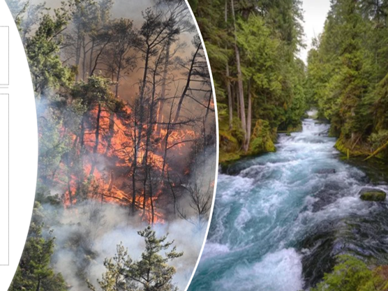
Wildfires are a natural process in many ecosystems, but they are increasing in size, severity, and frequency in many areas of the United States. After wildfire, loss of canopy vegetation and changes to soil properties can result in more water flowing over the land surface during storms, leading to flooding, erosion, and delivery of sediment, ash, pollutants, and debris to surface water. This can result in decreased water quality, loss of reservoir storage capacity, stream habitat degradation, and increased treatment costs for drinking water providers. The range of water-quality effects, however, has varied widely, from no noticeable change to 100-fold increases in concentrations and yields of sediment, nutrients, metals, and other constituents. Water providers, land managers, and the public would benefit from improved assessment and prediction of the character, magnitude, and duration of water-quality impacts after wildfire in watersheds across a wide range of ecoregions.
RELATED USGS WORK
The U.S. Geological Survey Water Resources Mission Area is working to build new capabilities to assist in planning for and adapting to acute and chronic stresses on water resources after wildfire. Consistent, strategic water-quality and -quantity data from burned areas across the western US are being collected. Interpretation of these new datasets, coupled with existing datasets, will clarify the critical drivers of post-wildfire water quality. Remote sensing approaches to rapidly characterize watershed conditions and directly identify wildfire effects on water quality are being developed. Blueprints identifying gaps in physically based distributed modeling and promising areas for model advancement are being built. These new tools are laying the foundation to advance capabilities to rapidly model and assess post-wildfire shifts in water availability. In addition, these tools could provide scenarios for potential changes in the concentrations of constituents of concern to water providers.
Some recent papers related to this work include:
A call for strategic water-quality monitoring to advance assessment and prediction of wildfire impacts on water supplies
This work describes strategic post-wildfire water-quality monitoring that could serve as a foundation for assessment and prediction of wildfire impacts on water supplies. Additional opportunities for improving our understanding of the nexus of wildfire, water, and society are described. https://www.usgs.gov/publications/a-call-strategic-water-quality-monitoring-advance-assessment-and-prediction-wildfire
Using air and stream-water temperatures to examine the post-wildfire groundwater shifts
This work used temperature differences between air and streamflow to examine how much groundwater is contributing to streamflow after wildfire. Streams with minimal pre-wildfire groundwater influence were more likely to have increases in groundwater contributions to streamflow after wildfire. https://www.sciencedirect.com/science/article/pii/S0022169423002147
Review and future directions for post-wildfire hydrologic modeling
This study reviewed and synthesized post-wildfire applications of numerical hydrologic models used to predict the magnitude and timing of hydrologic response to rainfall. Results summarize where models have been applied, how the models are set up, and how closely the models match measured responses to identify gaps and opportunities to improve hydrology modeling after fire. https://www.usgs.gov/publications/modeling-post-wildfire-hydrologic-response-review-and-future-directions-applications

Sources/Usage: Public Domain. View Media Details
The USGS is monitoring streamflow and water-quality in burned watersheds across the western U.S. These sites were selected based on a number of criteria, including availability of pre-wildfire data and the ability to install equipment that can measure water quality at high temporal resolution, in watersheds with a minimum percent burned and a lack of major water management, in order to best identify drivers of wildfire impacts on water quality. Water-quality data collection is focused on parameters that are critical to human and (or) ecosystem health, relevant to water-treatment processes and drinking-water quality, and (or) inform the role of precipitation and discharge on flow paths. The protocol is described in Murphy et al., 2023. (map by Rachel Sleeter, USGS).
ADDITIONAL RESOURCES
USGS wildland fire science (https://www.usgs.gov/special-topic/fire )
USGS data visualization (https://labs.waterdata.usgs.gov/visualizations/fire-hydro)
USGS California Water Science Center “Wildfires and Water” (https://ca.water.usgs.gov/wildfires/ )
^
Water Quality After Wildfire
Active
By Water Resources Mission Area April 11, 2023Wildfires pose a substantial risk to water supplies because they can lead to severe flooding, erosion, and delivery of sediment, nutrients, and metals to rivers, lakes, and reservoirs. The USGS works with federal and state land managers and local water providers to monitor and assess water quality after wildfires in order to help protect our Nation’s water resources.
BACKGROUND

Sources/Usage: Public Domain. View Media Details
Wildfires are a natural process in many ecosystems, but they are increasing in size, severity, and frequency in many areas of the United States. After wildfire, loss of canopy vegetation and changes to soil properties can result in more water flowing over the land surface during storms, leading to flooding, erosion, and delivery of sediment, ash, pollutants, and debris to surface water. This can result in decreased water quality, loss of reservoir storage capacity, stream habitat degradation, and increased treatment costs for drinking water providers. The range of water-quality effects, however, has varied widely, from no noticeable change to 100-fold increases in concentrations and yields of sediment, nutrients, metals, and other constituents. Water providers, land managers, and the public would benefit from improved assessment and prediction of the character, magnitude, and duration of water-quality impacts after wildfire in watersheds across a wide range of ecoregions.
RELATED USGS WORK
The U.S. Geological Survey Water Resources Mission Area is working to build new capabilities to assist in planning for and adapting to acute and chronic stresses on water resources after wildfire. Consistent, strategic water-quality and -quantity data from burned areas across the western US are being collected. Interpretation of these new datasets, coupled with existing datasets, will clarify the critical drivers of post-wildfire water quality. Remote sensing approaches to rapidly characterize watershed conditions and directly identify wildfire effects on water quality are being developed. Blueprints identifying gaps in physically based distributed modeling and promising areas for model advancement are being built. These new tools are laying the foundation to advance capabilities to rapidly model and assess post-wildfire shifts in water availability. In addition, these tools could provide scenarios for potential changes in the concentrations of constituents of concern to water providers.
Some recent papers related to this work include:
A call for strategic water-quality monitoring to advance assessment and prediction of wildfire impacts on water supplies
This work describes strategic post-wildfire water-quality monitoring that could serve as a foundation for assessment and prediction of wildfire impacts on water supplies. Additional opportunities for improving our understanding of the nexus of wildfire, water, and society are described. https://www.usgs.gov/publications/a-call-strategic-water-quality-monitoring-advance-assessment-and-prediction-wildfire
Using air and stream-water temperatures to examine the post-wildfire groundwater shifts
This work used temperature differences between air and streamflow to examine how much groundwater is contributing to streamflow after wildfire. Streams with minimal pre-wildfire groundwater influence were more likely to have increases in groundwater contributions to streamflow after wildfire. https://www.sciencedirect.com/science/article/pii/S0022169423002147
Review and future directions for post-wildfire hydrologic modeling
This study reviewed and synthesized post-wildfire applications of numerical hydrologic models used to predict the magnitude and timing of hydrologic response to rainfall. Results summarize where models have been applied, how the models are set up, and how closely the models match measured responses to identify gaps and opportunities to improve hydrology modeling after fire. https://www.usgs.gov/publications/modeling-post-wildfire-hydrologic-response-review-and-future-directions-applications
Sources/Usage: Public Domain. View Media Details
The USGS is monitoring streamflow and water-quality in burned watersheds across the western U.S. These sites were selected based on a number of criteria, including availability of pre-wildfire data and the ability to install equipment that can measure water quality at high temporal resolution, in watersheds with a minimum percent burned and a lack of major water management, in order to best identify drivers of wildfire impacts on water quality. Water-quality data collection is focused on parameters that are critical to human and (or) ecosystem health, relevant to water-treatment processes and drinking-water quality, and (or) inform the role of precipitation and discharge on flow paths. The protocol is described in Murphy et al., 2023. (map by Rachel Sleeter, USGS).
ADDITIONAL RESOURCES
USGS wildland fire science (https://www.usgs.gov/special-topic/fire )
USGS data visualization (https://labs.waterdata.usgs.gov/visualizations/fire-hydro)
USGS California Water Science Center “Wildfires and Water” (https://ca.water.usgs.gov/wildfires/ )
^
